The Geolander.it Method

Geolander.it is a 3-step method: acquisition, processing, delivery.
All items of information are organized within the Geolander.it Portal, where users can undertake the following activities:
- Navigate panoramic images produced by the survey;
- Navigate 3D maps with point clouds produced by the survey;
- Manage their assets using create, change and maintenance functions;
- Create their own business model using the Data Business Partner program.
#1 Acquisition
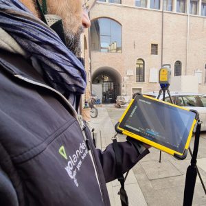
Our surveys are carried out with the aid of high grade technologies — mobile mapping systems (MMS), static laser scanners, drones, digital photogrammetry — which we deploy in all settings (outdoor and indoor) for surveying urban and rural areas, roads, buildings, homes and confined spaces.
Every survey produces two sources:
- high resolution panoramic images;
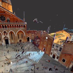
- Lidar data produced by laser-scanning.
Both sources are put into a single map from which to manage the extraction and organization of information held in the data surveyed both indoors and outdoors.
There are always two survey options:
Survey commissioned by the client
We conduct surveys utilizing our superior technology, which is placed on the Geolander.it Portal. This option envisages payment for the surveys and payment for access to two user licenses designated Geolander.it Vision (panoramic image management) and Geolander.it LasView (3D Lidar data management), available on the Geolander.it Portal.
Survey produced by the client
The client supplies us with survey data formatted to specific standards, which we upload and organize on the Geolander.it Portal. This option envisages payment for uploading the data and payment for access to the two user licenses, Geolander.it Vision (panoramic image management) and Geolander.it LasView (3D Lidar data management), available on the Geolander.it Portal.

#2 Processing
The purpose of the processing step is to generate the specified assets. Assets are managed on the Geolander.it Portal in the Fabrica configuration and can be produced either by our team or by way of an automated deep learning procedure.
The assets that can be activated currently are:
- Street numbers and access ways
- Road signs
- Place-name signs
- Advertising posters and hoardings
- Lighting points
- Trees
- Public green assets
- Street furniture
- Drains
- Parking spaces and car parks
- Road register
- Grave maps and cemetery registers
- Public and private buildings
There are two options for release of the Processing step:
Extraction by the team
The Fabrica license for the asset is activated, so it can be entered with the data produced in the previous step. The asset is generated by our team with Geolander.it Fabrica on the Geolander.it Portal.
Extraction by the client
The Fabrica license for the asset is activated, so it can be entered with the data produced in the previous step. The asset is generated by the client with Geolander.it Fabrica on the Geolander.it Portal.

#3 Delivery
The Geolander.it Portal reproduces every item of real world data or information virtually, so as to create a perfectly identical pairing (Digital Twin).
The digitized area undergoes an innovative analysis to allow planning for the future, with design of the Smart City in view.
This allows the use of a single geographic database, served by multiple application tools — web-based or mobile apps — which will have the specific functionalities required, case by case.
Geolander.it Portal is a SAAS service (Software As A Service), hosted on a Cloud Service Provider certified by AGID, which can be used on the web or on mobile apps and offers unique features, namely:

a complete suite of products for the management and organization of geographic data acquired from surveys conducted by Geolander.it or by third parties
management of 3D mapping functions, starting from point clouds produced by surveys
availability of REST API services for the integration of panoramic image and Lidar data navigation functions
pre-prepared dashboards for processing of IOT data in a Smart City context
facility of using panoramic images obtained from surveys conducted by Geolander.it or by third parties
access to data management via web services complying with OGC (Open GIS Consortium) standard
web mapping services based on market-leader technologies (ESRI) adopted by the main Italian regions
machine learning functions for automatic extraction of objects from high resolution images.